
Project Capacity & Team Extension
Flexible GIS, data, mapping, and technical support when your team needs extra capacity, short-term help, or specialized project delivery.

What This Service Helps with
Project teams often have more GIS, mapping, data, and reporting work than internal staff can realistically handle. Deadlines, proposals, field programs, reporting periods, data cleanup, dashboard requests, and client deliverables can quickly create extra workload.
OrbitalIQ provides flexible support that can plug into your team when you need additional GIS or data capacity without hiring full-time staff.
This is useful when your team needs to:
Add short-term GIS or data support for a busy project
Handle overflow mapping, analysis, cleanup, or reporting tasks
Support proposals, deadlines, field programs, or project deliverables
Bring in specialized GIS, dashboard, automation, or data-cleanup support
Keep projects moving when internal teams are at capacity
Get reliable technical support without a long-term commitment
Typical Deliverables
Project maps and report figures
GIS analysis outputs
Cleaned spatial and tabular datasets
Web maps and hosted feature layers
ArcGIS Dashboards
Survey123 or Field Maps workflows
QA/QC issue logs
Data summaries and reporting tables
Proposal maps and graphics
Field-ready layers
Geodatabases and shapefiles
Workflow documentation and handoff notes
Core Support Areas
-
Flexible support for map production, spatial analysis, layer preparation, web maps, project figures, data updates, and GIS tasks that internal teams may not have time to complete.
-
Support for defined project tasks, deadlines, and deliverables. This can include preparing datasets, building dashboards, creating maps, running analysis, cleaning data, or supporting reporting requirements.
-
GIS and mapping support for proposals, technical reports, assessment packages, planning documents, client updates, and presentation materials.
-
Preparation of field-ready GIS layers, mobile maps, Survey123 or Field Maps workflows, inspection forms, photo-enabled records, and offline data collection tools.
-
Support for creating or updating ArcGIS Dashboards, web maps, hosted feature layers, reporting views, and interactive tools that help teams communicate project information.
-
OrbitalIQ can work alongside internal GIS, planning, engineering, environmental, survey, resource, or project teams as an external technical resource for specific tasks or ongoing project support.
Example Use Cases
Overflow Mapping Support
Helping a project team complete map production, layer cleanup, spatial overlays, or report figures when internal staff are already at capacity.
Short-Term GIS Project Support
Supporting a defined GIS task or delivery package over a short project window, such as a dashboard, data cleanup workflow, web map, field workflow, or spatial analysis request.
Field Season Support
Preparing mobile GIS layers, inspection forms, field maps, offline access, and structured data workflows before field crews begin work.
Proposal & Client Deliverables
Creating clean maps, spatial summaries, figures, and supporting GIS outputs for proposals, client reports, public-sector submissions, or internal review packages.
Technical Backup for Internal Teams
Providing additional GIS, data, automation, or dashboard support so internal teams can stay focused on project management, client communication, and higher-priority work.
Selected Work Examples
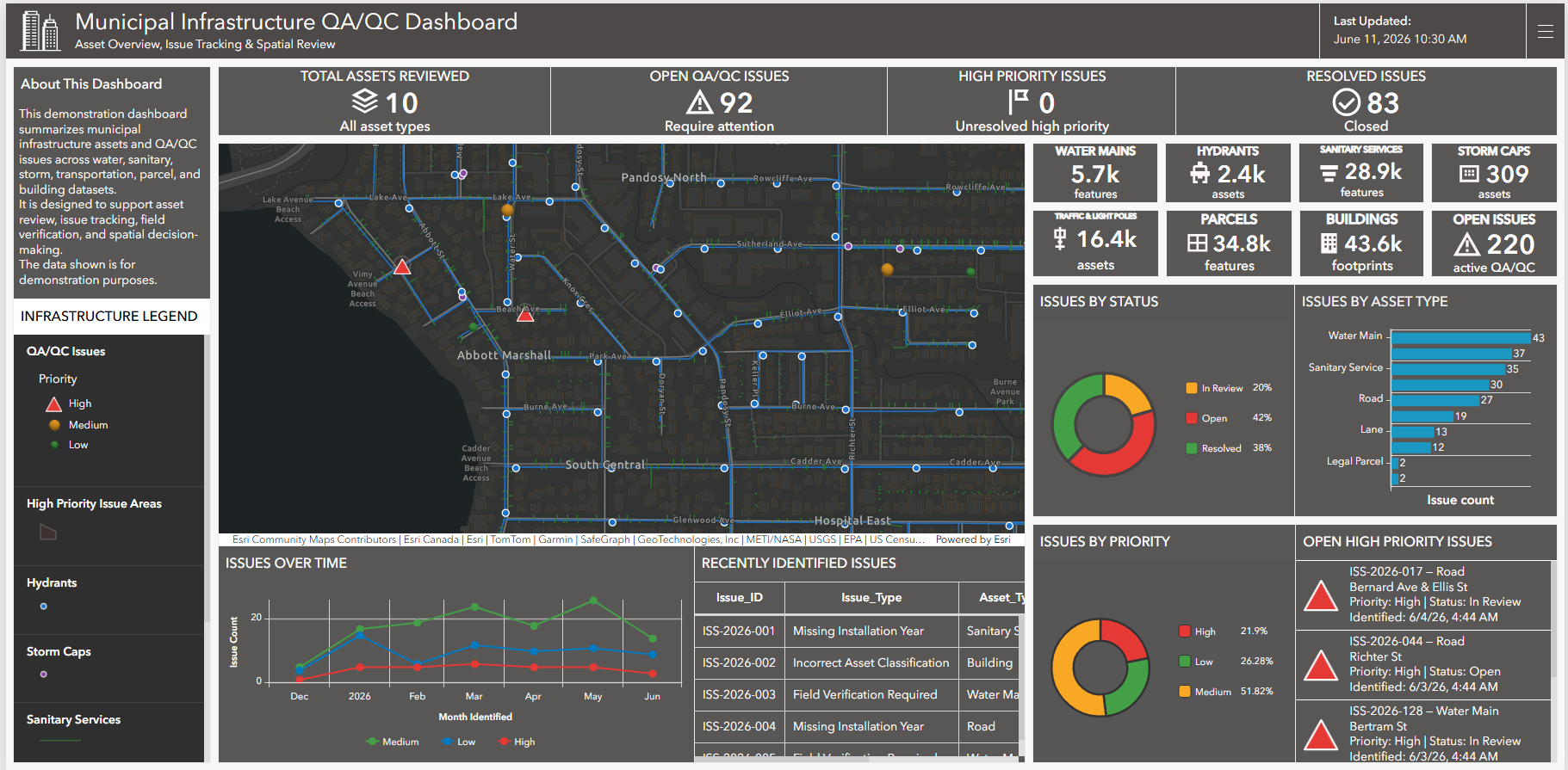
Interactive dashboard showing municipal infrastructure layers, asset summaries, QA/QC issue records, priority tracking, and spatial review tools in one decision-support view.

CAD-GIS workflow showing how survey, infrastructure, and spatial data can be organized, converted, and prepared for mapping, analysis, and project delivery.
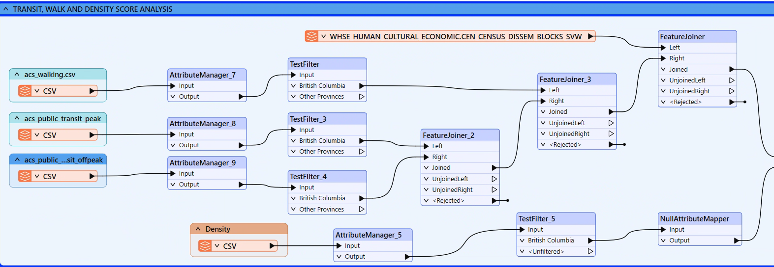
Automated FME workflow combining parcel, census, transit, infrastructure, and scoring inputs into a structured analysis-ready dataset.