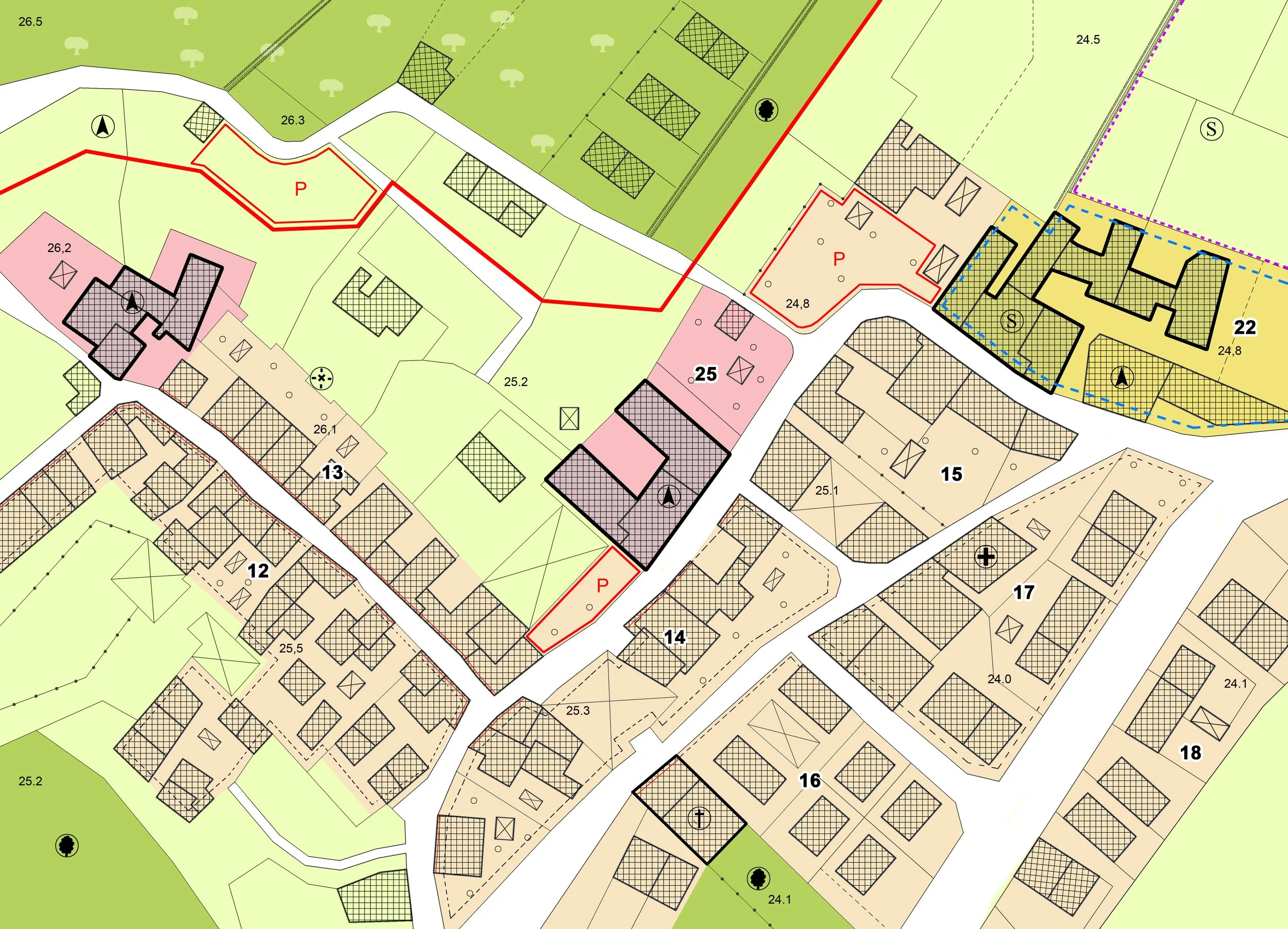
Built a map-based view of parcels, zoning, imagery, site notes, constraints, drawings, and project status for development planning.
Land development work often starts with a simple question: “What do we know about this site, and what still needs to be checked?” The answer is usually spread across parcels, zoning, aerial imagery, drawings, environmental notes, servicing information, planning documents, emails, and consultant files.
This project brought development-related information into a single interactive map so the team could understand the site, review constraints, coordinate next steps, and communicate more clearly.
Project Summary
OrbitalIQ completed a development-focused mapping project for a client who needed a clearer way to view project information across a site. Instead of keeping parcels, drawings, constraints, imagery, and notes in separate places, the information was structured into a map-based workflow.
The output helped the team move from scattered project references to a shared view of the site that could support planning, coordination, and decision-making
-
The first step was to identify what the team needed to know about the site and how the map would be used.
Reviewed parcel, zoning, aerial imagery, drawing, and site-context needs
Identified constraints, project notes, and reference layers
Confirmed who needed to use the map and what decisions it should support
-
Relevant information was collected, cleaned, and organized so it could be used in one map-based view.
Compiled parcels, zoning, imagery, boundaries, and project reference layers.
Added site notes, drawings, status information, and key context.
Organized layers so users could turn information on and off as needed.
-
The project information was turned into a practical map that could be used for review, meetings, and coordination.
Configured web map layers and pop-ups.
Created a clean structure for notes, drawings, and status updates.
Prepared map views for internal users, clients, or project partners.
-
The final step was making sure the map could keep supporting the project after initial setup.
Prepared documentation and update guidance.
Reviewed how the team could maintain project information.
Provided support for revisions and additional layers where needed.
-
Interactive project map
Site context layers
Parcel, zoning, and imagery reference layers
Drawing and document links where appropriate
Project status or note-tracking fields
Map views for internal review or client communication
Update and handoff guidance
Project Phases
Working on a development site where the information is spread across drawings, emails, spreadsheets, maps, and planning documents?
OrbitalIQ Solutions can help turn that information into a clear map-based view that your team can use for planning, coordination, and communication.