GIS, Mapping & Spatial Analysis
Practical mapping, spatial analysis, and geospatial workflows that help teams understand location-based problems, evaluate project constraints, and make better decisions.
What This Service Helps with
Many projects depend on understanding where things are, how they relate spatially, and what constraints or opportunities exist across a site, service area, property, corridor, or landscape.
OrbitalIQ helps turn spatial data into clear maps, analysis outputs, and decision-ready GIS products. This can include project mapping, overlay analysis, site review, terrain analysis, parcel mapping, land-use context, infrastructure mapping, environmental constraints, and web map preparation.
This is useful when your team needs to:
Understand spatial relationships between parcels, assets, constraints, and project areas
Create clean project maps for reports, proposals, planning, or communication
Analyze land-use, infrastructure, environmental, terrain, or access conditions
Combine multiple GIS layers into one clear project view
Identify suitable areas, priority locations, or review zones
Prepare spatial outputs for stakeholders, field teams, consultants, or decision-makers
Typical Deliverables
PDF map layouts
Web maps
Spatial analysis outputs
Site suitability or constraint layers
Parcel, infrastructure, and land-use maps
Project geodatabases
Clean GIS layers
Map packages
Spatial summaries and area calculations
Overlay analysis results
Terrain, imagery, and environmental context maps
Field-ready map layers
Documentation and handoff notes
Core Support Areas
-
Clear, professional maps for planning, reporting, proposals, technical review, field programs, and stakeholder communication. Maps can include parcels, roads, infrastructure, terrain, imagery, boundaries, environmental layers, and project-specific data.
-
Analysis that compares project areas against relevant spatial layers such as parcels, zoning, water features, roads, environmental constraints, infrastructure, terrain, tenure, administrative boundaries, or land-use information.
-
GIS workflows that help identify suitable areas, constrained locations, priority sites, or locations requiring further review. This can support land development, infrastructure planning, environmental review, housing analysis, resource projects, and public-sector decision-making.
-
Mapping and analysis of parcels, buildings, roads, utilities, land-use designations, zoning, municipal infrastructure, and related project context.
-
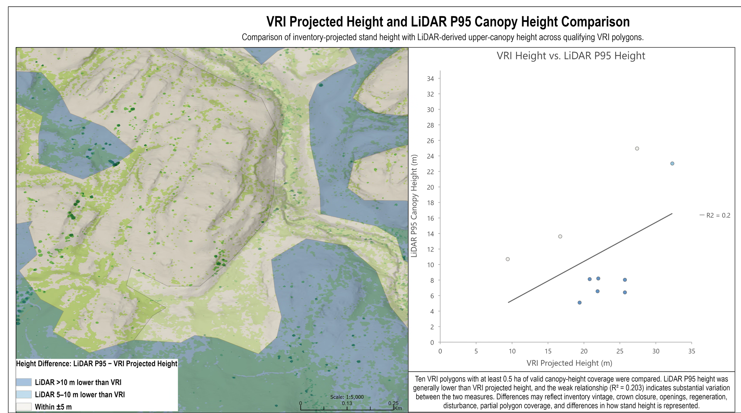
Use of elevation models, LiDAR-derived products, imagery, hydrology, slope, drainage, vegetation, and environmental layers to support terrain-based and land-base analysis.
-
Preparation of GIS layers and map designs for ArcGIS Online, web maps, dashboards, field applications, and interactive project review.
Example Use Cases
Site Review & Constraint Mapping
Combining parcels, zoning, roads, services, environmental constraints, water features, terrain, and land-use data to support early-stage site review or project planning.
Infrastructure & Asset Mapping
Mapping municipal or project infrastructure layers such as roads, buildings, utilities, hydrants, sanitary services, storm features, and related assets for review, QA/QC, or reporting.
Environmental & Natural Resource Mapping
Using GIS layers such as hydrology, terrain, vegetation, access, administrative boundaries, protected areas, and field observations to support environmental or land-based review.
Terrain & Drainage Analysis
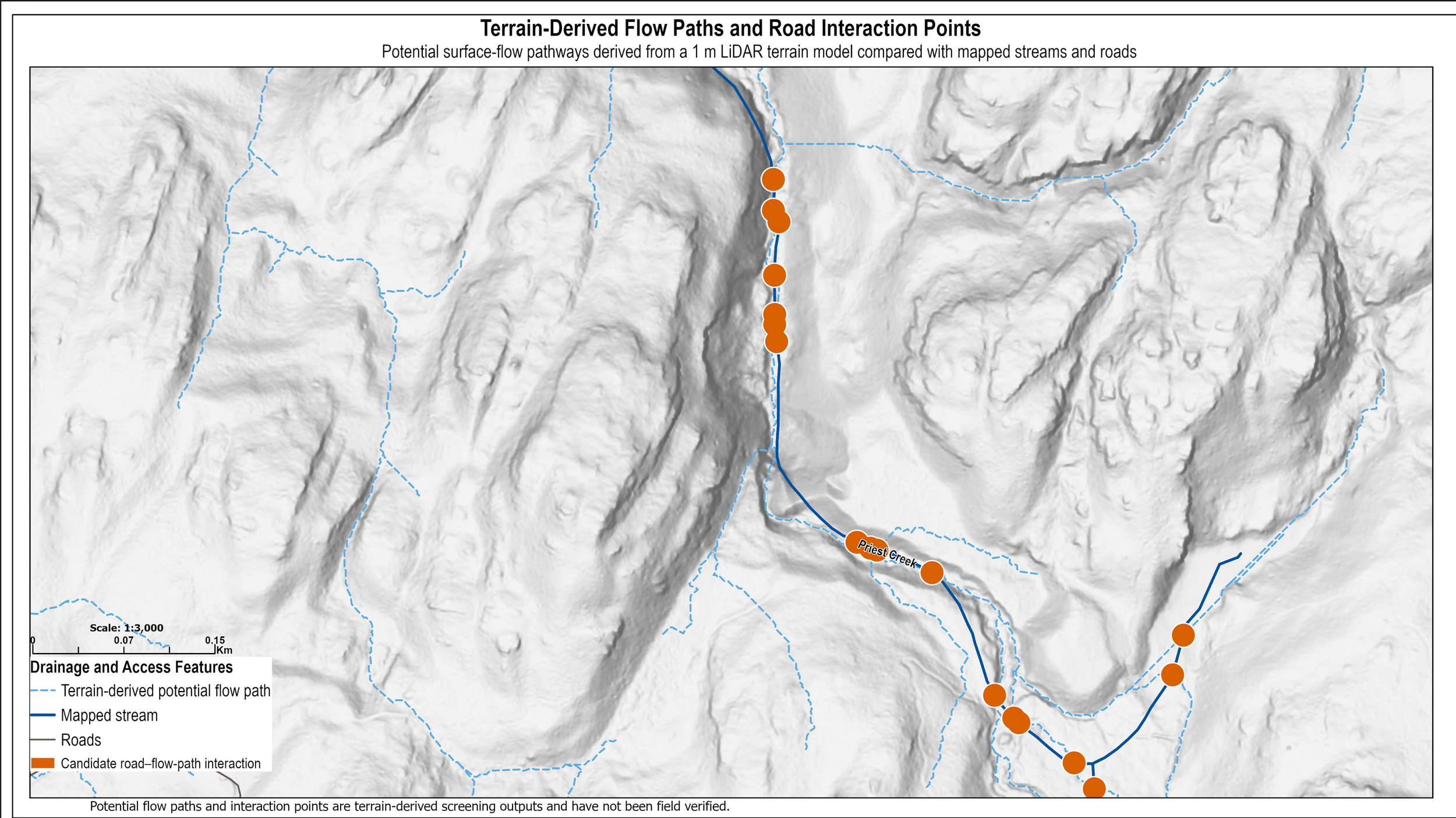
Using elevation, LiDAR, hillshade, slope, drainage, and surface models to better understand terrain conditions, landform patterns, and site-level spatial context.
Decision-Support Mapping
Creating maps and spatial outputs that help teams compare options, communicate priorities, and support project decisions with clear geographic evidence.
Related Project Example